Facts & Demographics
Overview
- Polk County was founded on Dec. 22, 1845
- The County was named for James Knox Polk, the 11th President of the United States
- The County seat is located at Dallas, Oregon
- Polk County is home to Western Oregon University and an excellent public school system
- Polk County is governed by a 3-member Board of Commissioners who serve 4-year terms
- Polk County is a blend of both rural and urban communities, and operates under a detailed Comprehensive Land Use Plan
Location/Climate
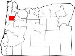
- Polk County is located in the heart of the lush Willamette Valley, approximately 15 miles west of Salem, Oregon
- Residents enjoy a moderate, four season climate with an average of 222 days of sunshine and an average of 52 inches of precipitation each year
- August is the warmest month (Avg. High: 81)
- January is the coolest month (Avg. High: 39)
Geography Quick Facts
- Land Area: 744 square miles
- Persons per Square Mile: 102
- Statistical Area: Salem Metropolitan Area
Demographics
- Population: 79,122 (2010 Census)
- Population Increase 2000 - 2009: 25.2%
- Estimated Housing Units: 27,857
- Median Household Income: $53,506

